Planning Proposal, Ralston Avenue, Belrose
Planning Proposal - not proceeded

Background
The Metropolitan Local Aboriginal Land Council (MLALC) is proposing to separate their land, a total of 135.3 hectares, into two areas:
A. An area of 17.15 hectares (12.7% of the total area) is proposed to be rezoned to R2 Low Density Residential and RE1 Public Recreation. The Planning Proposal states that this land is to subdivided into 169 residential lots and allow for the development of a variety of housing types. A maximum building height of 8.5 metres is proposed to be applied to the residential area as per the nearby residential areas.
B. Up to 118.15 hectares (87.3% of the total area) is proposed to be rezoned E3 Environmental Management which will provide for a limited range of development in the interest of protecting the lands ecological and aesthetic values. However, a proportion of this vegetation may need to be managed to limit the risk to the new residential development from bushfire.
Updates
Document Library
Document Library
-
Planning Proposal Flow Chart to June 3 2013PDF (13.68 KB)
-
Draft Preliminary Biocertification Report - August 2013PDF (5.04 MB)
-
Additional studies as requested by Council - August 2013PDF (9.20 MB)
-
Response to Council feedback on initial Planning Proposal - July 2013PDF (2.81 MB)
-
Council Report 25 November 2014 - Relevant Planning AuthorityPDF (3.19 MB)
-
Original Planning Proposal – April 2013PDF (10.14 MB)
-
Appendix B Ecological Constraints and Biodiversity Offsets Analysis – April 2013PDF (4.63 MB)
-
Appendix E Bushfire Protection Assessment – April 2013PDF (3.42 MB)
-
Appendix G Zoning and Building Height Maps – April 2013PDF (6.50 MB)
-
Appendix A Concept Plan – April 2013PDF (4.41 MB)
-
Appendix C Open Space and Recreation Study – April 2013PDF (6.39 MB)
-
Appendix D Infrastructure Services and Water Management Strategy – April 2013PDF (2.49 MB)
-
Appendix D (part) Electromagnetic Field Impact AssessmentPDF (698.34 KB)
-
Appendix F Assessment of Traffic Implications – April 2013PDF (8.05 MB)
-
Appendix H Economic Impact Assessment – April 2013PDF (977.42 KB)
-
Appendix I Housing Needs Study – April 2013PDF (1.07 MB)
-
Appendix J Aboriginal Archaeological Assessment – April 2013PDF (1.60 MB)
-
Appendix K Contamination Assessment – April 2013PDF (7.72 MB)
-
Appendix L Geotechnical Assessment – April 2013PDF (6.99 MB)
-
Appendix M Social Impact Assessment – April 2013PDF (1.54 MB)
-
Appendix N Electrical Services Strategy – April 2013PDF (656.22 KB)
-
Appendix O Consultation Report – April 2013PDF (355.58 KB)
-
Appendix P Survey Plan – April 2013PDF (2.13 MB)
-
Appendix Q Pre Lodgement Letter and Response – April 2013PDF (261.20 KB)
-
Supplementary Planning Report and Updated Planning Proposal - 28 April 2017PDF (1.83 MB)
-
Appendix A2 - Extension of the Gateway Determination - 28 April 2017PDF (43.49 KB)
-
Appendix A1 - Gateway determination - 28 April 2017PDF (3.99 MB)
-
Appendix B - Bushfire Protection Assessment_Part1 - 28 April 2017PDF (3.60 MB)
-
Appendix B - Bushfire Protection Assessment_Part2 - 28 April 2017PDF (4.35 MB)
-
Appendix B - Bushfire Protection Assessment_Part3 - 28 April 2017PDF (3.25 MB)
-
Appendix B - Bushfire Protection Assessment_Part4 - 28 April 2017PDF (2.41 MB)
-
Appendix C - Fuel Management Plan_Part2 - 28 April 2017PDF (4.45 MB)
-
Appendix C - Fuel Management Plan_Part1 - 28 April 2017PDF (4.60 MB)
-
Appendix C - Fuel Management Plan_Part3 - 28 April 2017PDF (2.94 MB)
-
Appendix D - Ecological Assessment_Part1 - 28 April 2017PDF (4.40 MB)
-
Appendix D - Ecological Assessment_Part2 - 28 April 2017PDF (3.76 MB)
-
Appendix D - Ecological Assessment_Part3 - 28 April 2017PDF (3.82 MB)
-
Appendix D - Ecological Assessment_Part4 - 28 April 2017PDF (4.31 MB)
-
Appendix D - Ecological Assessment_Part5 - 28 April 2017PDF (1.90 MB)
-
Appendix E - Indicative Subdivision Plan - 28 April 2017PDF (1.42 MB)
-
Appendix F1 - Zoning Map - Total Site - 28 April 2017PDF (4.47 MB)
-
Appendix F2 - Zoning Map - Areas - 28 April 2017PDF (177.91 KB)
-
Appendix F3 - Zoning Map - Aerial - 28 April 2017PDF (954.08 KB)
-
Appendix F4 - Height of Buildings - 28 April 2017PDF (1.06 MB)
-
Appendix G1 - Draft VPA and Explanatory Note - Resubmitted 2 May 17PDF (374.98 KB)
-
Appendix G2 - Works Area Plan - 28 April 2017PDF (244.98 KB)
-
Appendix G4 - Independent Valuation - Proposed Public Park - 28 April 2017PDF (2.14 MB)
-
Appendix G3 - Estimated Value Summary - 28 April 2017PDF (76.59 KB)
-
Gateway Determination 28 January 2015PDF (3.99 MB)
-
Gateway request for extension 22 December 2015PDF (43.49 KB)
-
Alteration of Gateway 12 May 2017PDF (99.13 KB)
-
Referral Response - NSW Rural Fire Service - 20 February 2015PDF (317.65 KB)
-
Referral Response - Office of Environment and Heritage - 27 February 2015PDF (2.80 MB)
-
Referral Response - Roads & Maritime Services (RMS) 10 March 2015PDF (145.55 KB)
-
Applicants Public Authority Response - Ralston Avenue Planning Proposal - 18 May 2015 - 2015/143220PDF (4.90 MB)
-
Letter from RFS - in reply to the Applicant's response to RFS submission - 26 June 2015PDF (156.57 KB)
-
2nd Letter from RFS - in reply to the Applicant's response to RFS submission - 9 July 2015PDF (98.61 KB)
-
Letter from Office Environmental Heritage - in reply to the Applicant's response to OEH submission - 30 June 2015PDF (572.56 KB)
-
Applicants response to RFS - Travers - 11 August 2015PDF (5.49 MB)
-
Transport for NSW referral comments - Ralston Avenue Planning Proposal - 3 March 2016PDF (125.63 KB)
-
Applicant's response to Transport for NSW referral comments - 9 March 2016PDF (376.75 KB)
-
OEH advice - Ralston Avenue Biodiversity Certification - 9 February 2016PDF (280.92 KB)
-
Blackash Bushfire Consulting - Peer Review of Ralston Ave Planning Proposal - Bushfire Planning - April 2016PDF (14.08 MB)
-
Referral Response - NSW Rural Fire Service - 23 Sep 2016PDF (178.61 KB)
-
Applicants Response to Blackash Bushfire Consulting Report Dec 9 2016PDF (10.33 MB)
-
Applicants Response to the NSW Rural Fire Service (RFS) Nov 3 2016PDF (12.69 MB)
-
Council Assessment Report dated 19 December 2017PDF (1.30 MB)
-
Attachment Booklet including: 1 Planning Proposal Assessment; 2 Public Authority and Utility Responses; 3 Council Natural Environment Response; 4 Council Internal Referrals; 5 VPA Feedback and Response; 6 Community Feedback and ResponsePDF (596.90 KB)
-
Strategic Bushfire Review (Blackash Consulting) – 20 September 2017PDF (38.54 MB)
-
Referral Response – Office of Environment and Heritage – 26 June 2017PDF (1.30 MB)
-
Referral Response – Sydney Water – 21 August 2017PDF (974.12 KB)
-
Referral Response – Ausgrid – 12 July 2017PDF (97.12 KB)
-
Referral Response – TransGrid – 13 July 2017PDF (10.32 MB)
-
Referral Response – Roads and Maritime Services – 18 July 2017PDF (70.05 KB)
-
Referral Response – Rural Fire Services – 18 October 2017PDF (1.01 MB)
-
Gateway Determination – Oxford Falls Strategic Land Review – October 2017PDF (238.85 KB)
-
Proponent response to public submissions and public authority comments (Urbis) – 25 October 2017PDF (260.30 KB)
-
Proponent revised Transport, Traffic and Assessment Report (Transport and Traffic Planning Associates) - September 2017PDF (3.71 MB)
-
Proponent Noise Impact Assessment of TransGrid Substation (TTM) - October 2017PDF (2.96 MB)
-
Proponent Response to RFS’s October 2017 Referral Response (Travers Bushfire and Ecology) - October 2017PDF (177.11 KB)
-
Proponent Aboriginal Archaeological & Cultural Heritage Assessment (Dominic Steele Consulting Archaeology) – 1 November 2017PDF (2.91 MB)
-
Council resolution 19 December 2017PDF (79.16 KB)
-
Letter from the Department of Planning and Environment - referral of matter to Planning Assessment Commission – 21 December 2017PDF (59.78 KB)
-
Letter from DPE to PAC - Request for Consideration of Matter - 21 December 2017PDF (894.99 KB)
Links
- Original Planning Proposal – April 2013
- Appendix B Ecological Constraints and Biodiversity Offsets Analysis – April 2013
- Appendix E Bushfire Protection Assessment – April 2013
- Appendix G Zoning and Building Height Maps – April 2013
- Appendix A Concept Plan – April 2013
- Appendix C Open Space and Recreation Study – April 2013
- Appendix D Infrastructure Services and Water Management Strategy – April 2013
- Appendix D (part) Electromagnetic Field Impact Assessment
- Appendix F Assessment of Traffic Implications – April 2013
- Appendix H Economic Impact Assessment – April 2013
- Appendix I Housing Needs Study – April 2013
- Appendix J Aboriginal Archaeological Assessment – April 2013
- Appendix K Contamination Assessment – April 2013
- Appendix L Geotechnical Assessment – April 2013
- Appendix M Social Impact Assessment – April 2013
- Appendix N Electrical Services Strategy – April 2013
- Appendix O Consultation Report – April 2013
- Appendix P Survey Plan – April 2013
- Appendix Q Pre Lodgement Letter and Response – April 2013
FAQ
FAQ
- What land is affected by the Ralston Avenue Planning Proposal?
The Planning Proposal relates to part of Lot 1 in DP 1139826. The majority of land is bushland and has not been assigned a specific street address.
- Who owns the land?
The land is owned by the Metropolitan Local Aboriginal Land Council (MLALC).
- Who is the Metropolitan Local Aboriginal Land Council and what do they do?
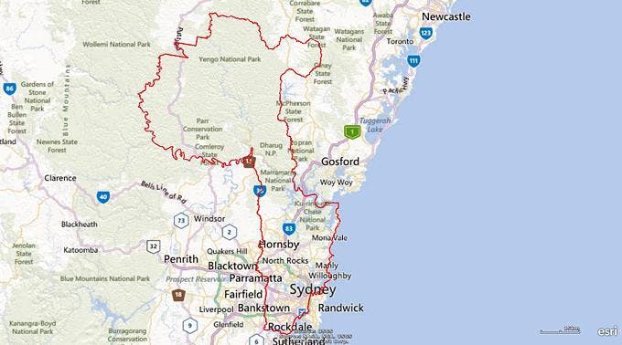
The MLALC is a statutory body constituted under the Aboriginal Land Rights Act 1983. The MLALC’s land boundaries cover a significant component of Sydney, as shown on the map of the region.The primary objective of the MLALC is to:
“improve, protect and foster the best interests of all Aboriginal persons within the council area and other persons who are members of the council”.
Their functions include:
- Making land claims in respect to vacant crown land
- Acquire land and to use, manage, control, hold or dispose of, or otherwise deal with, land vested in or acquired by the Land Council
- Protect the interests of Aboriginal persons in its area in relation to the acquisition, management, use, control and disposal of land
- Take action to protect the culture and heritage of Aboriginal persons in the Council’s area, subject to any other law
- Promote awareness in the community of the culture and heritage of Aboriginal persons in the Council’s area
- Prepare and implement, in accordance with the Act, a community, land and business plan
- Facilitate business enterprise in accordance with the Aboriginal Land Rights Act 1983, regulations, and community, land and business plans
- Directly, or indirectly, provide community benefits under the community benefits scheme;
- Provide, acquire, upgrade or extend residential accommodation for Aboriginal persons within its area
- Establish or participate in the establishment of a trust for the purpose of providing a community benefits scheme
For more information, please visit the MLALC’s website.
- Why is a planning proposal necessary and what does it seek to achieve?
The preparation of a planning proposal is the first step in amending a Local Environmental Plan. A planning proposal explains the effect of and justification for an amendment; and must be submitted to the Department of Planning and Environment when seeking a Gateway Determination. A planning proposal must be drafted in accordance with the NSW Department of Planning and Environment’s:
• Guide to preparing planning proposals
• Guide to preparing local environmental plans- What is the history of this proposal?
The Applicant submitted a draft Planning Proposal to Council in April 2013. This proposal was publicly exhibited in June 2013 and received feedback from the community and State Government Authorities. At its meeting on 17 December 2013, Council elected not to forward the Ralston Avenue Planning Proposal to the Department of Planning and Environment to seek a Gateway Determination. Effectively, this meant that Council had refused the proposal.
On 28 January 2014, the Metropolitan Local Aboriginal Land Council lodged a request for a ‘Pre-Gateway review’ which required the Department of Planning and Environment to re-consider the proposal and Council's decision. A Gateway Determination was subsequently issued by the Department 28 January 2015.
From 2015 to 2017, Council has undergone extensive consultation with the Applicant and State government authorities (Rural Fire Service, Office of Environment and Heritage, Roads & Maritime Services, and Transport for NSW). In accordance with the Gateway Determination further studies were undertaken and a number of revisions were submitted by the Applicant. Concerns were raised by the Rural Fire Service and Office of Environment and Heritage regarding respectively bushfire and biodiversity impacts.
The Applicant has responded to these concerns in a revised Planning Proposal lodged with Council on 28 April 2017.
Council is exhibiting the revised Planning Proposal in accordance with the Alteration to Gateway determination issued by the Department of Planning and Environment on 12 May 2017. This requires a report to Council on the Planning Proposal in July 2017.
- What development is proposed under the Planning Proposal?
The Planning Proposal seeks to amend Warringah Local Environmental Plan 2011 (WLEP 2011) to rezone 136.62 hectares of land at the western end of Ralston Avenue, Belrose to:
- R2 Low Density Residential - 17.27 hectares (12.6% of the site) with a yield of 156 lots, based upon a minimum lot size of 600 square metres and a maximum building height of 8.5 metres
- RE1 Public Recreation - 0.3 hectares (0.2% of the site)
- E3 Environmental Management - 119.05 hectares (87.2% of the site)
- Who is the applicant?
The Metropolitan Local Aboriginal Land Council (MLALC) is the Applicant for the Planning Proposal. The Applicant can be contacted as follows:
Email: info@northbelrose.com.au
Telephone: 1800 252 040
Website: www.northbelrose.com.au- Who will develop the land?
The MLALC propose to develop the land in partnership with Matthews Civil Pty Ltd.
- What is the planning process for the Planning Proposal?
Following public exhibition of the draft Planning Proposal, Council staff will report the results of the public exhibition back to Council including comments received by the relevant State Government Authorities.
Council staff will then undertake a full assessment of the Planning Proposal and a recommendation will be made to Council whether to support it. Council’s decision will be forwarded to the Department of Planning and Environment for final determination.- Where can I view the Planning Proposal?
The Planning Proposal, VPA and accompanying documents may be inspected either
- Online at either:
- yoursay.northernbeaches.nsw.gov.au/Ralston-planning-proposal
- yoursay.northernbeaches.nsw.gov.au/Voluntaryplanningagreements
- Council's Customer Service Centres in Manly, Dee Why, Mona Vale , or
- Council’s Libraries (Forestville, Warringah Mall, Dee Why, and at the new Glen Street Library opening 3 June 2017)
- What are the conditions of the Gateway Determination?
The Department of Planning and Environment issued a Gateway Determination on the 28 January 2015, following a pre-Gateway review process. The Gateway Determination:
- required consultation with the NSW Rural Fire Service, Office of Environment and Heritage (OEH), and Transport for NSW - Roads and Maritime Services
- provided the applicant with a right to respond to the comments made by the public authorities
- required several amendments to be made to the Planning Proposal prior to exhibition including:
- Minimum lot size of 600m2 and a maximum height of building of 8.5m
- Replace all references to the E2 Environmental Conservation zone with the E3 Environmental Management zone
- Update the Planning Proposal to rezone the land R2 Low Density Residential, E3 Environmental Management and RE1 Public Recreation
- Update the Planning Proposal to reflect ‘A Plan for Growing Sydney’
Due to the complexity of the proposal and required further consultation, Council wrote to the Department of Planning in December 2015 requesting an extension for completing the local environmental plan.
The Department of Planning and Environment provided an Alteration to Gateway in May 2017, with the following conditions:
- A deadline for completing the Local Environmental Plan by 28 January 2018
- A requirement to report the planning proposal to a Council meeting within 2 months of the date of the Alteration to Gateway determination (12 May 2017)
- What development is permissible in Zone E3 Environmental Management?
An objective of the E3 Environmental Management Zone is to protect, manage and restore areas with special ecological, scientific, cultural or aesthetic values. Only a limited range of development is permissible in this area as set out in the Land Use Table in the WLEP2011. A proportion of vegetation in this area may need to be managed to limit the risk to the new residential development from bushfire.
- What development is permissible on the site currently?
The subject site is located within the C8 Belrose North Locality under Warringah Local Environmental Plan 2000 (WLEP 2000). This Locality has a maximum housing density of 1 dwelling per 20 ha of site area.
The C8 Belrose North Locality was deferred from Warringah’s comprehensive WLEP 2011 and is the subject of a separate “deferred lands” Planning Proposal currently being considered by the Department of Planning and Environment. That Planning Proposal incorporates recommendations from a Strategic Land Review and proposes to rezone the entire site to E3 Environmental Management.
Council must decide whether to continue to support the “deferred lands” Planning Proposal as it relates to the site or to support the proposed zones as outlined in the Ralston Avenue Planning Proposal.
- What changes were made to the original Planning Proposal?
The Applicant submitted a revised Planning Proposal in response to the Gateway determination and feedback provided by Council and the State government authorities and agencies during the pre-exhibition consultation. The changes include:
- Replacing the proposed Zone E2 Environmental Conservation with Zone E3 Environmental Management
- An amalgamation of the original proposed pocket parks (Zone RE1 Public Recreation zones) into a larger consolidated public open space area to the south-west of the R2 Low Density Residential zone
- An increase in the minimum lot size from 550m2 to 600m2
- The protection of the Duffys Forest Ecological Community through a reconfiguration of the site
- Changes to the areas for rezoning, including:
- A net reduction of the developable area from 17.79 hectares in the original proposal to 17.27 hectares in the current proposal
- An increase in Zone E3 Environmental Management land from 118.37 hectares to 119.05 hectares
- A decrease in the potential future residential lots from 171 to 156 lots
- What about impacts from Bushfire?
One of the reasons for Council’s decision to refuse the Planning Proposal at the 17 December 2013 Council meeting were concerns regarding an unacceptable risk of bushfire in the area.
The most recent correspondence from the Rural Fire Service (RFS) concludes that the Planning Proposal is not consistent with the Ministerial s117 directions under the Environmental Planning and Assessment Act 1979 and should not proceed in its current form.
The Applicant has provided updated bushfire planning information as part of their revised Planning Proposal to respond to the concerns expressed by the RFS.
Council has engaged a separate bushfire consultant to help with the assessment of the Applicant’s bushfire planning proposals. This assessment will be provided to Council in conjunction with a report by Council staff.- What about impacts on the bushland and biodiversity?
The land subject to the Planning Proposal has high environmental values. Concern exists that the Planning Proposal may result in a significant loss of biodiversity, due to presence on the site of the following threatened species / endangered ecological communities:
Flora
- Duffys Forest Endangered Ecological Community
- Coastal Upland Swamp Endangered Ecological Community
- Grevillia Caleyi
- Tetratheca Glandulosa
Fauna
- Giant Burrowing Frog
- Red-crowned Toadlet
- Rosenbergs Goanna
- Powerful Owl
- Little Lorrikeet
- Grey-headed Flying-fox
- Little Bentwing-bat
- Eastern Bentwing-bat
- Spotted-tailed Quoll
- Eastern Pygmy Possum
- Southern Brown Bandicoot
Submissions from the Office of Environment and Heritage (OEH) state that they do not support the Planning Proposal given the significant environmental impacts that would result from the rezoning.
The applicant has submitted detailed plans and documentation to respond to the concerns raised by Council and the Office of Environment and Heritage.
Council and the OEH will consider the environmental impacts of the revised Planning Proposal and provide comment in the report to Council.
- Is Biodiversity Certification Proposed?
Biodiversity certification is a process whereby areas of high conservation value are identified and protected early in the planning process. This results in an environmental approval for the whole of the development area at the time of rezoning, rather than each subsequent Development Application requiring a separate assessment of impacts on biodiversity and threatened species.
Biodiversity certification is optional and requires a planning authority (e.g. Council or a State Government Department) to propose the area for certification.
The Applicant has proposed biodiversity certification in conjunction with the Planning Proposal following recommendations by the Office of Environment and Heritage. However, Council has determined it will not pursue biodiversity certification for the land unless it supports the Planning Proposal in principle.
Consequently, biodiversity certification will be considered in the report to Council following public exhibition of the Planning Proposal.- What is the Voluntary Planning Agreement?
The draft Voluntary Planning Agreement (VPA) accompanies the Ralston Ave (Belrose) Planning Proposal and proposes the creation of a number of public benefits. If agreed, the VPA would be between Northern Beaches Council and Metropolitan Local Aboriginal Land Council.
The draft VPA was submitted to Council on 28 April 2017. It follows a number of revisions based on discussions with Council, the Office of Environment and Heritage and Rural Fire Service since 2015.
Council has not yet formed a view whether to enter into the draft VPA and will report the matter back to Council following submissions. The decision whether to support the VPA will be guided by Council’s VPA Policy.
- What does the draft VPA Propose?
The draft VPA proposes the following public benefits:
- Design and construct new traffic treatment at Forest Way/ Ralston Ave Belrose.
- Design and construct new public roads, internal to site (approx. 3,700m)
- Upgrade existing external Council road (Ralston Ave - external to site - approx. 270m)
- Design and construct new external Council road (Wyatt Ave - external to site - approx. 680m)
- Design and construct new Council footpaths (Ralston Ave & Wyatt Ave – external to site - approx. 800 lineal metres) and existing Road corridor (approx. 950 lineal metres) and new formed Ralston and Wyatt Ave – external to site
- Design and construct new internal 1m wide footpaths (approx. 3,700 m)
- Upgrade walking trails/paths to National Park (approx. 1.5 km)
- Public access to New Warringah Aboriginal Nature Reserve (approx.119 hectares), with direct access to the Garigal National Park– including provision of cultural interpretative signage – (also covers insurance & signage costs)
- Dedication of land for 3,000 m2 for public park and valley view lookout
- Construction of new 3,000 m2 public park, and maintenance for 2 years
- Public outdoor gymnasium equipment supply and installation of 15 items
- Design and construct new Belrose Nature Run (3km running track)
- Design and construct water management facilities, including ongoing maintenance
- Provision of four new bus shelters
- $100,000 Contribution to Council for Local Community facility
- Waratah Park - Engagement of MLALC Ecological and Cultural Heritage Officer for 5 years
- MLALC Waratah Park – facilities upgrades
- MLALC aboriginal services (housing, employment, training, health, youth)
- Establishment of Aboriginal Youth Foundation
- Bush Fire APZ Management contract
- Implementation of a Bio-Certification agreement across the MLALC Ralston Ave, Belrose Site area for the ongoing preservation on the Offset land area (approximately 119 ha) in accordance with the Ralston Avenue, Belrose – Biodiversity Assessment Report and Biodiversity Certification Strategy document dated 14 January 2016.
- Can I talk to someone?
You can attend a drop-in session and speak with Council staff on Wed 7 Jun, 5 - 7pm at Glen Street Library. We invite you to register your interest to attend this session. The Northern Beaches Council contact is Suzy Lawrence, Senior Strategic Planner, 9942 2111 or council@northernbeaches.nsw.gov.au.
You can also contact the Applicant Phone: 1800 252 040; Website: www.northbelrose.com.au or Email: info@northbelrose.com.au. Note that submissions must be lodged with Council.
- What happens if I make a submission?
Your submission will be formally acknowledged and may be made publicly available on Council’s website as per the Government Information (Public Access) Act 2009 (GIPA) and associated Regulation 2009 (GIPA Regulation). This will include any personal information contained in your submission unless you specifically indicate otherwise in writing to Council. You are not required by law to supply Council with your name and address but you should note that without these details, officers might not be able to access the accuracy of any issues you raise or acknowledge your submission.
Any person who makes a relevant public submission is required to disclose reportable political donations and gifts (if any) made by the person making the submission or any associate of that person within the period commencing 2 years before the submission is made and ending when the application is determined. Please visit Council’s website www.northernbeaches.nsw.gov.au or Council's Customer Service Centres at Dee Why, Manly and Mona Vale for further details about the Political Donations Act 2008 and for Declaration Forms.
Any matters you raise in your submission will be considered as part of Council’s assessment of the Planning Proposal. A report will be considered by Council regarding the proposal at a future date that is yet to be determined.
- How will my personal information in my submission be used?
Your information is collected by Council to help provide services to the community. It is used by Northern Beaches Council staff only. Supply of personal information in your submission is voluntary. If you wish to access or correct your personal information, you may do so by an informal GIPA application, available on Council’s website.


